News that matters in AmericaReporting on public life, technology, money, and policy in the United States.
NOAA says a G3 geomagnetic storm watch is in effect for June 4 and June 5 as CMEs are forecast to interact with Earth. Aurora visibility tonight will depend on final storm strength, darkness, cloud cover and the latest SWPC forecast maps.
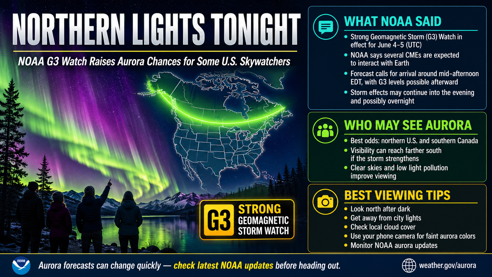
The northern lights are possible for some U.S. skywatchers Thursday night after NOAA issued a G3 geomagnetic storm watch for June 4 and June 5. NOAA said stronger geomagnetic activity could develop after a forecast CME arrival around mid-afternoon ET, but whether auroras are visible where you are will depend on final storm strength, darkness and clouds.
The Space Weather Prediction Center said three coronal mass ejections are expected to interact with Earth. Its latest update said the combined arrival is forecast around mid-afternoon ET Thursday, with up to G3 conditions possible afterward and CME passage likely continuing into the evening and possibly overnight.
A G3 watch means strong geomagnetic storm conditions are predicted, not guaranteed at a specific location. NOAA’s alerts page listed G3 as the highest storm level predicted for June 4 and June 5, with June 6 below G1.
The storm setup is better aligned with Thursday night than with daylight hours, but the sky still needs to be dark. NOAA says auroras are usually best within an hour or two of midnight, roughly 10 p.m. to 2 a.m. at the viewing site, with the window stretching earlier or later during stronger activity.
For most readers, the practical window is after sunset through the overnight hours. Check again before heading out because aurora forecasts can change quickly as the CME reaches monitoring spacecraft and Earth’s magnetic field responds.
The best odds are still in higher-latitude areas and across the northern tier of the U.S., especially places with a clear view to the north. NOAA’s G3 scale description says aurora has been seen as low as Illinois and Oregon during strong geomagnetic storms, but that is a general reference for G3 conditions, not a promise that those states will see aurora tonight.
Distance from city lights matters. NOAA’s viewing tips advise getting away from bright urban areas and finding an unobstructed northern horizon. Cloud cover can block a display even if space-weather conditions are favorable.
Use NOAA’s Space Weather Prediction Center Aurora Dashboard for the latest official aurora forecast maps. The dashboard links to the “Tonight’s Aurora Viewline Forecast,” “Tomorrow Night’s Aurora Viewline Forecast” and the Aurora 30-Minute Forecast.
NOAA says the tonight-and-tomorrow product is based on its OVATION model and uses maximum forecast Kp between 6 p.m. and 6 a.m. CT. The images update continuously, and the product rolls forward each day, so refresh the dashboard rather than relying on an older screenshot.
For a shorter-term decision, use NOAA’s 30-minute aurora forecast. That map estimates the location and intensity of aurora 30 to 90 minutes ahead, based on solar-wind data upstream of Earth.
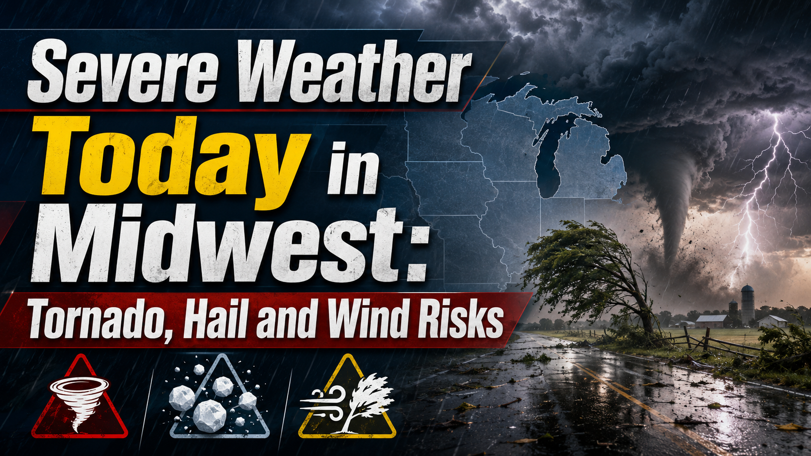
Parts of the Upper and Mid Mississippi valleys and Midwest face an Enhanced Risk for severe storms Wednesday, with tornadoes, large hail and damaging winds possible. Residents should monitor National Weather Service alerts and be ready to shelter if warnings are issued.
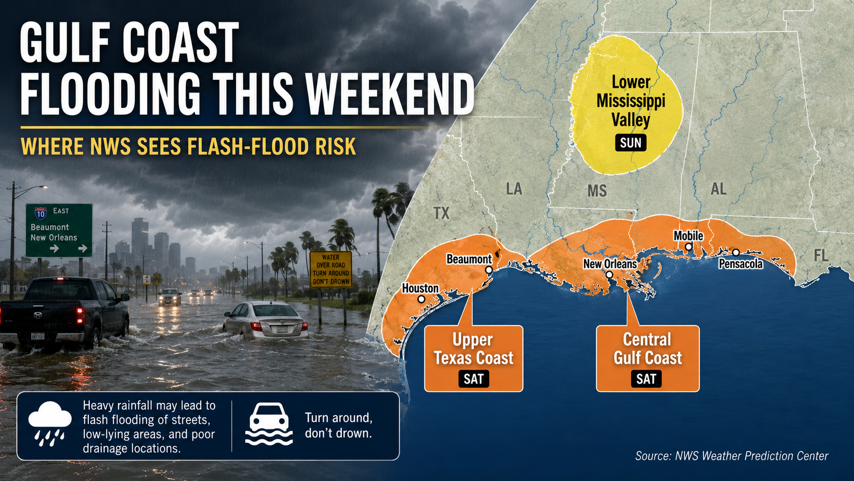
Parts of the Gulf Coast face localized flash-flood risk this weekend as heavy showers and storms move inland from the Gulf. The National Hurricane Center says tropical cyclone formation is not expected during the next seven days.

A geomagnetic storm watch can be upgraded, extended, canceled or replaced by warnings as real-time data arrives. The most important updates to watch are NOAA’s alerts, the latest Kp forecast and the 30-minute aurora map after dark.
If the CME arrives earlier, later or weaker than forecast, the viewing window and southern reach could change substantially. For now, the official answer is that aurora is possible Thursday night for some U.S. viewers, with the best chance in dark, northern locations and with up-to-date NOAA map checks before going outside.
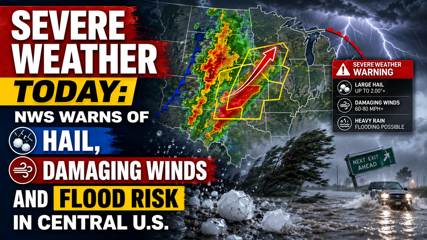
The National Weather Service says parts of the central U.S. face severe thunderstorms today, with large hail, damaging winds, isolated tornado risk and flooding possible. The main risk areas stretch from the central Plains into the Midwest, with a separate heavy-rain threat from Texas into the Mississippi Valley.