News that matters in AmericaReporting on public life, technology, money, and policy in the United States.
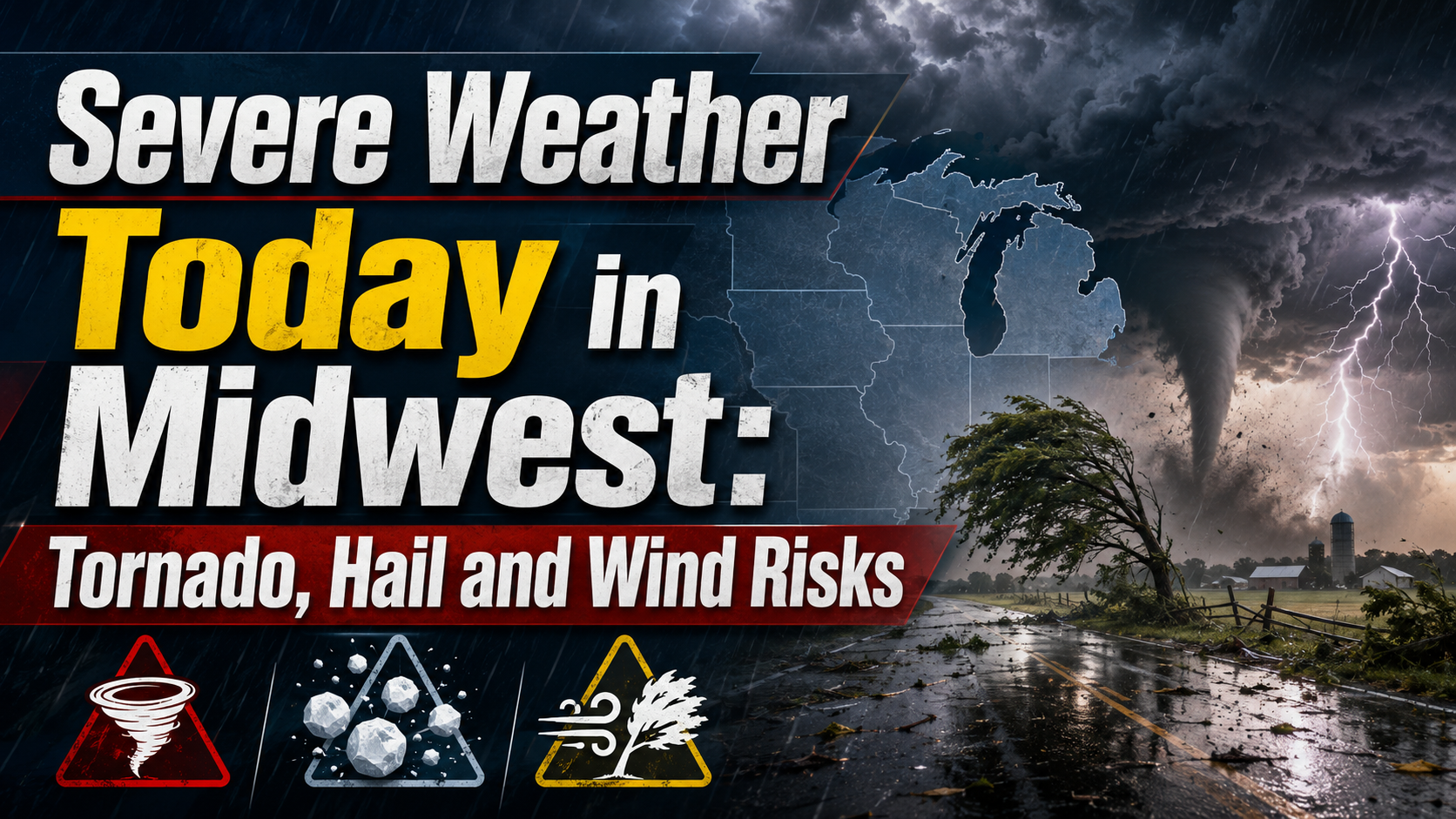
The National Weather Service says parts of the central U.S. face severe thunderstorms today, with large hail, damaging winds, isolated tornado risk and flooding possible. The main risk areas stretch from the central Plains into the Midwest, with a separate heavy-rain threat from Texas into the Mississippi Valley.
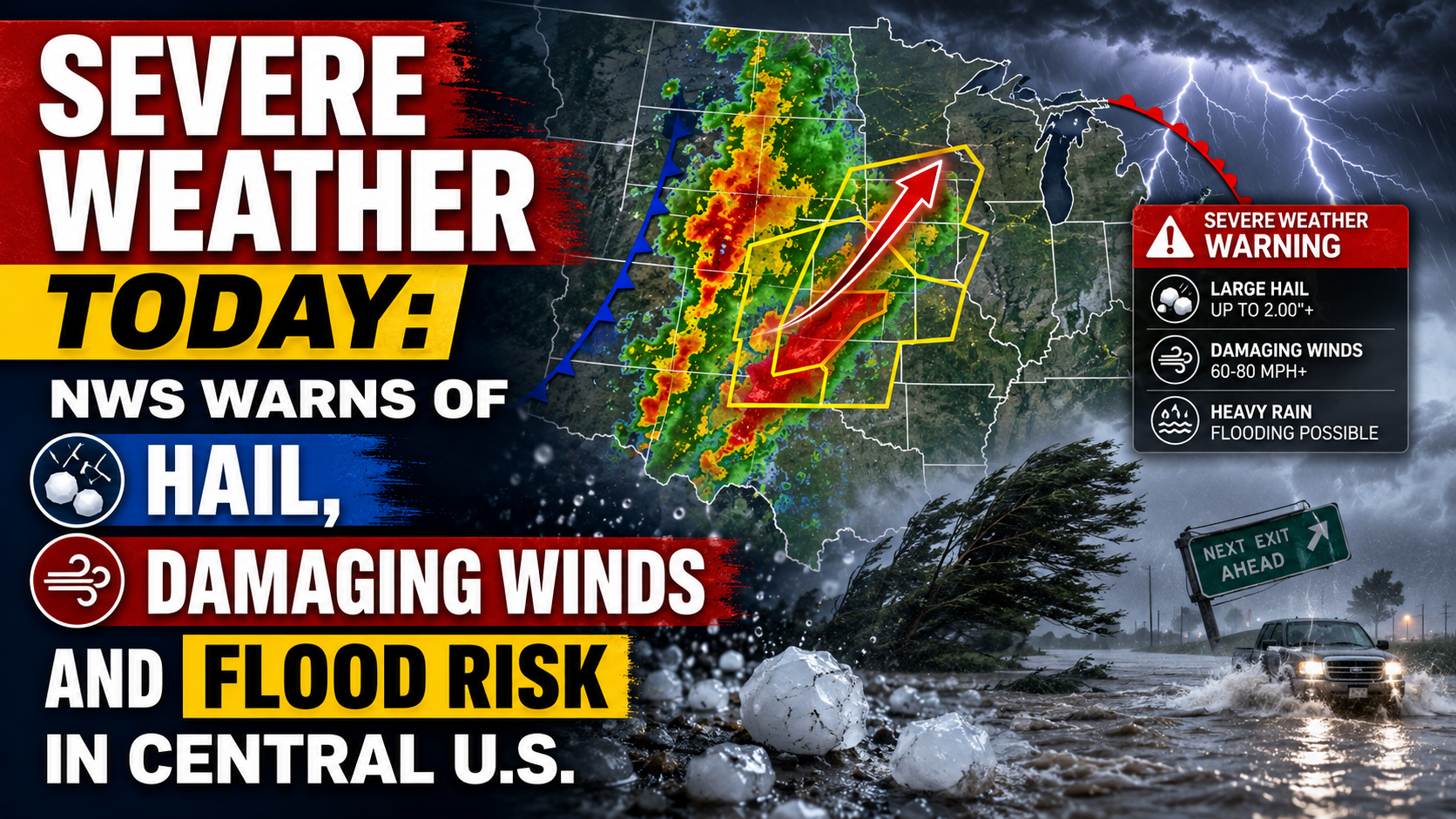
Severe weather today is focused on parts of the central U.S., where the National Weather Service says storms may bring large hail, damaging winds, isolated tornadoes and flooding. The most focused severe thunderstorm risk runs from the central Plains into the Mid-Missouri and Mid-Mississippi valleys, while heavy rain could also cause flooding from Texas into parts of the Mississippi Valley.
The Storm Prediction Center placed a Slight Risk for severe thunderstorms across parts of the central Plains, the Mid-Missouri Valley and the Mid-Mississippi Valley. Its larger city examples in that zone included Omaha, Lincoln, Des Moines, Aurora, Illinois, and Naperville, Illinois.
A broader Marginal Risk extended over a wider part of the Midwest and central U.S., with larger city examples including Chicago, Milwaukee, Kansas City, Minneapolis and St. Paul.
SPC said storms are expected to develop late this afternoon and evening. Initial storms may form near the strongest instability in eastern Nebraska, south-central Iowa and nearby areas before spreading east and southeast into parts of northern Missouri and north-central Illinois.
Large hail and severe wind gusts are the main hazards in the latest SPC outlook. The agency said the strongest supercells could produce hailstones greater than 2 inches in diameter, especially early in the event.
The wind threat is expected to rise if storms organize into a line. In the more intense portions of that line, a few wind gusts could exceed 70 mph, according to the SPC discussion.
The tornado risk is lower than the hail and wind risk, but not zero. SPC’s tornado probability graphic included a 2% area that covered some of the same larger city examples, including Omaha, Lincoln, Des Moines, Aurora and Naperville. The broader NWS national outlook also said isolated tornadoes are possible in parts of the central U.S. through the weekend.
The Weather Prediction Center placed Slight Risks for excessive rainfall across portions of eastern Nebraska and Kansas into the Mid-Mississippi Valley, and across much of Texas and southern Oklahoma.
In Texas and southern Oklahoma, WPC said scattered thunderstorms could have ingredients for flash flooding, with the exact focus for the heaviest rain still uncertain. The discussion also highlighted parts of the Texas Hill Country, Concho Valley and Permian Basin as sensitive areas included in the risk zone.
A separate WPC mesoscale discussion early Friday said heavy rain was still possible across northern Missouri and southern and eastern Iowa through mid-morning, with localized rainfall rates as high as 1.5 inches per hour and some additional flash flooding possible.
SPC’s current convective watches page showed no valid severe thunderstorm or tornado watches at its 7:43 a.m. ET update. That does not remove the severe weather risk later today; watches can be issued when conditions become more favorable for organized severe storms.
Parts of the Upper and Mid Mississippi valleys and Midwest face an Enhanced Risk for severe storms Wednesday, with tornadoes, large hail and damaging winds possible. Residents should monitor National Weather Service alerts and be ready to shelter if warnings are issued.
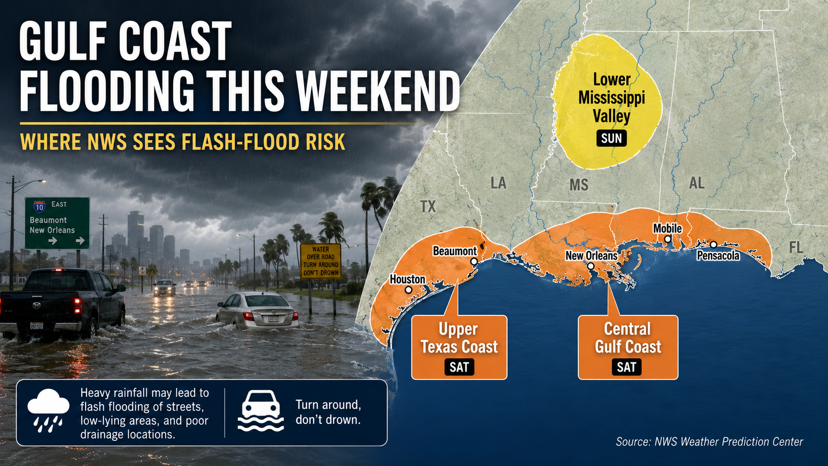
Parts of the Gulf Coast face localized flash-flood risk this weekend as heavy showers and storms move inland from the Gulf. The National Hurricane Center says tropical cyclone formation is not expected during the next seven days.

County-level warnings can change faster than national outlooks. Readers in the risk area should use local NWS alerts, wireless emergency alerts and NOAA Weather Radio where available.
For severe thunderstorm warnings, move inside a sturdy building and stay away from windows. Large hail can break glass, and damaging winds can bring down trees and power lines.
For tornado warnings, go to a basement, storm shelter or small interior room on the lowest floor of a sturdy building. Avoid windows and do not stay in a mobile home if a safer shelter is available.
For flooding, do not drive across water covering a road. NWS safety guidance says to turn around rather than cross flooded roadways, because water depth and road damage may not be visible.
The forecast should be refreshed after the next SPC Day 1 outlook and whenever new NWS watches, warnings or flood discussions are issued.
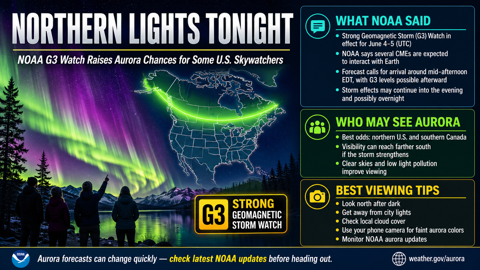
NOAA says a G3 geomagnetic storm watch is in effect for June 4 and June 5 as CMEs are forecast to interact with Earth. Aurora visibility tonight will depend on final storm strength, darkness, cloud cover and the latest SWPC forecast maps.