News that matters globallyReporting on public life and major developments across the U.S., the UK, and beyond.
NOAA’s Storm Prediction Center placed parts of the Central Plains under an Enhanced Risk for severe storms Saturday, with large hail, damaging wind and a few tornadoes possible. The greatest risk is expected this afternoon and evening, with flash flooding possible into early Sunday.
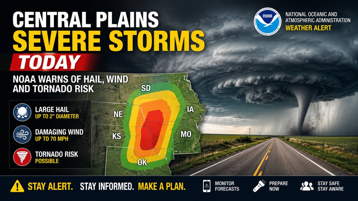
Severe storms are expected across parts of the Central Plains today, with NOAA’s Storm Prediction Center placing part of the region under an Enhanced Risk. People in and near the risk area should have more than one way to receive warnings and be ready to move indoors quickly if storms approach.
The Enhanced Risk area includes parts of the Central Plains, with the Storm Prediction Center’s population list naming Salina, Manhattan, Garden City, Hays and Junction City in Kansas among the larger population centers inside that zone.
A broader Slight Risk extends into areas including Kansas City, Missouri; Wichita; Lincoln; Overland Park; and Kansas City, Kansas. The outlook does not mean every location will see severe weather, but it signals that storms capable of producing damage are possible where they form and track.
The Storm Prediction Center said large to very large hail, severe winds and a few tornadoes are possible. The strongest storms could produce hail larger than 2 inches and isolated wind gusts over 75 mph, especially if storms organize into bowing clusters later in the day.
Tornado potential is lower than the hail and wind threat but is not zero. The center said a few tornadoes could develop mainly late this afternoon into the evening, either with persistent supercells or within storm clusters.
The main severe threat is expected mainly this afternoon and evening. The Storm Prediction Center said storms may first develop along and east of the higher terrain of eastern Colorado and southeast Wyoming, then strengthen as they move east into Kansas and Nebraska.
By late afternoon and evening, storms may merge into one or more clusters moving east-southeast across Nebraska and Kansas. A severe wind threat may continue overnight farther east across Kansas and perhaps into western Missouri.
During the last check, the Storm Prediction Center’s current watches page listed no valid convective watches, and its mesoscale-discussion page listed no active discussion. That can change quickly once storms begin to develop, so residents should check local National Weather Service alerts through the day.
The Weather Prediction Center also placed parts of the Central Plains and Lower Missouri Valley under a Moderate Risk for excessive rainfall. It said a developing storm complex could bring widespread heavy rainfall and flash flooding from this evening into early Sunday.
The greatest flash-flood concern was forecast across southeastern Nebraska, northeastern Kansas, far northwestern Missouri and southwestern Iowa. The Weather Prediction Center said rainfall totals along the expected storm path could average 2 to 4 inches, with locally higher amounts possible.
The National Weather Service office for Kansas City/Pleasant Hill said a Flood Watch goes into effect Saturday evening for western Missouri and eastern Kansas, with saturated soils raising the risk of rapid runoff and quick-onset flooding.
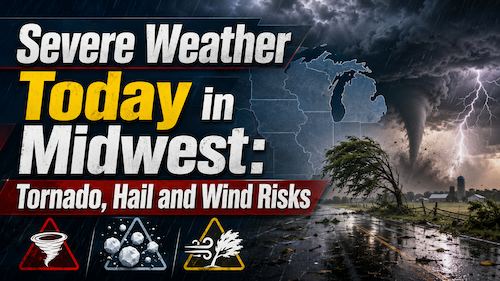
Parts of the Upper and Mid Mississippi valleys and Midwest face an Enhanced Risk for severe storms Wednesday, with tornadoes, large hail and damaging winds possible. Residents should monitor National Weather Service alerts and be ready to shelter if warnings are issued.
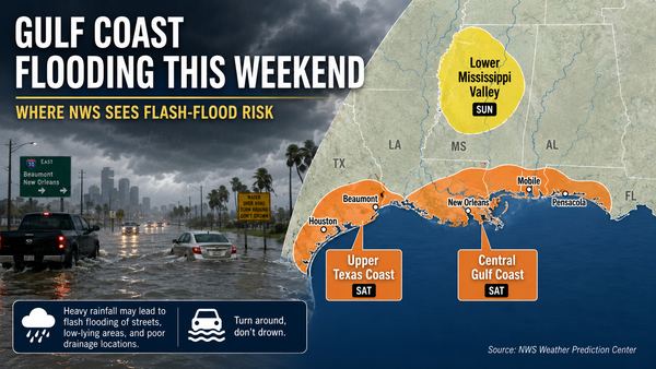
Parts of the Gulf Coast face localized flash-flood risk this weekend as heavy showers and storms move inland from the Gulf. The National Hurricane Center says tropical cyclone formation is not expected during the next seven days.


Do not wait for a siren. Make sure phone alerts are enabled, keep a weather radio or trusted local alert source nearby, and know your shelter before storms arrive.
For a tornado warning, move to a basement or a small interior room on the lowest floor, away from windows. For severe thunderstorm warnings with large hail or damaging wind, move indoors and stay away from windows. Bring pets inside and secure loose outdoor items if there is time.
Do not drive across water-covered roads. If flooding develops, turn around and use another route.
Check the Storm Prediction Center for updated severe-weather outlooks, your local National Weather Service office for watches and warnings, and local emergency alerts for road closures or shelter instructions. This article should be updated if the Storm Prediction Center issues a new outlook, severe thunderstorm or tornado watches are posted, or local warnings expand.
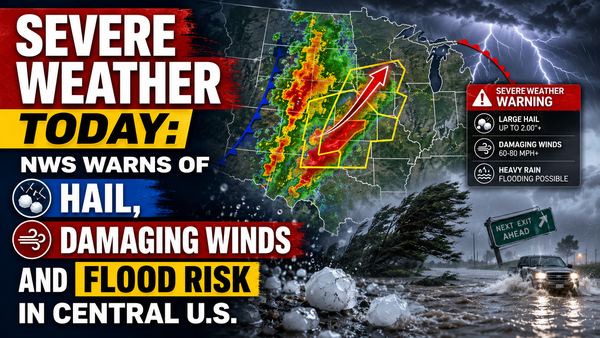
The National Weather Service says parts of the central U.S. face severe thunderstorms today, with large hail, damaging winds, isolated tornado risk and flooding possible. The main risk areas stretch from the central Plains into the Midwest, with a separate heavy-rain threat from Texas into the Mississippi Valley.